Location and Maps
(choose from one of the map option Tabs below)Location
Dilwyn is located about 13 miles north-west from the city of Hereford and some 6 miles south-west from its nearest town, Leominster.
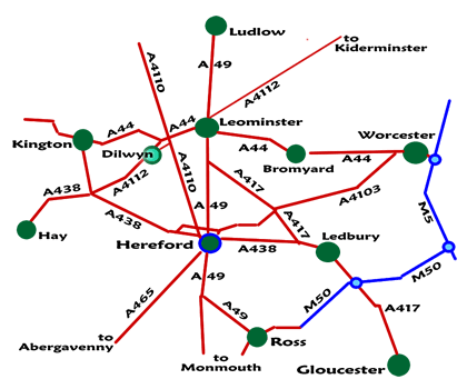 Dilwyn is situated on the northern edge of a broad valley that stretches from the west near the river Wye through to Leominster. Running through the valley, south of the village, is the Stretford Brook whilst to the north are the rivers Arrow and Lugg.
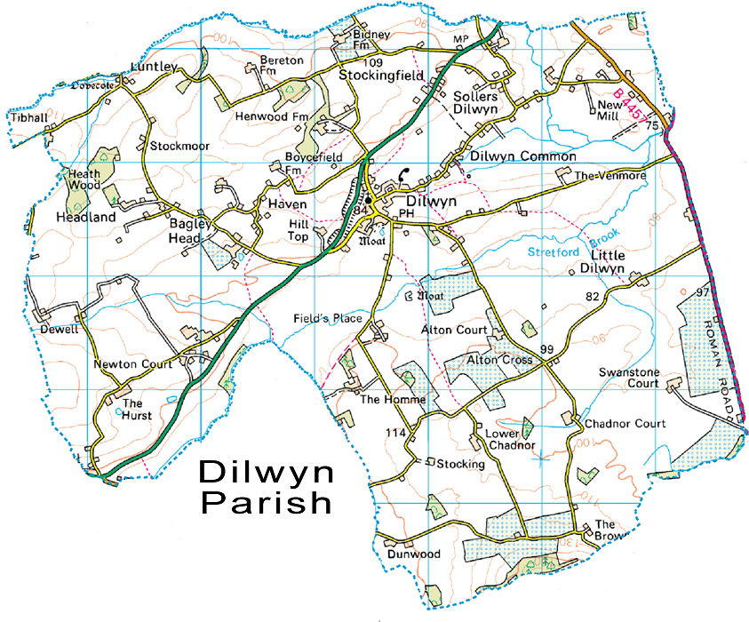
Dilwyn civil parish includes the hamlets of Sollers Dilwyn, Little Dilwyn, The Haven, Hill Top, The Hurst, Headland, Bearton, Bidney, Henwood, Stockmoor and Stockingfield amongst others. There are 300 dwellings spread throughout the 6400 acres of the parish. The population in 2011 was 711.
Weobley, Eardisland and Pembridge are the three closest villages to Dilwyn. The above four villages form part of The Black and White Trail which explores the attractive half-timbered, black and white villages to be found in this area of northern Herefordshire. The landscape of the parish and surrounding area is mainly rolling arable and pastoral farmland with many scattered orchards.
To the east of Dilwyn village, the main road running north/south (A4110) follows the line of Watling Street West, an important Roman road and one that also marks the eastern boundary of the parish.
Boundary Map
Source National Statistics - Crown Copyright
Reproduced under the terms of the Click-Use Licence (No. C2007001044)
held by the Dilwyn Community Website.
Reproduced under the terms of the Click-Use Licence (No. C2007001044)
held by the Dilwyn Community Website.
Conservation Area
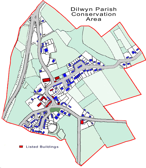 Dilwyn's conservation area was originally designated in 1974 under the old Leominster District Council. It covers the core central village of the parish of Dilwyn.
A conservation area is defined under the Herefordshire Council's Unitary Development Plan (UDP) as an area of special architectural or historic interest, the character and appearance of which should be conserved or enhanced. This plan sets out criteria for designating and reviewing conservation areas, and on how planning applications for development within such areas will be considered.
Residential development can only take place on allocated and windfall sites within a defined settlement boundary within the conservation area.
Dilwyn Conservation Area includes the village of Dilwyn and the rural area that immediately surrounds the village on its periphery. Within the conservation area, heritage assets include fifteen Listed Buildings, i.e., one Grade I building (church) and fourteen Grade II buildings or structures, and one Scheduled Monument (castle mound, south of village green). Ten unlisted buildings are identified as buildings of local interest. All of these buildings and structures, together with the area’s mature trees and hedgerows, walls, gardens, open spaces and views, contribute to the special architectural and historic character of this Conservation Area.
Acknowlegements: Dilwyn Conservation Area Appraisal - Herefordshire Council - July 2006